Global Navigation Satellite System
As the world moves towards more efficient and seamless toll collection systems, India is at the forefront of revolutionizing tolling infrastructure by adopting Global Navigation Satellite (GNSS)-based tolling. Metro Infrasys is proud to be part of this innovative journey, leading the charge with cutting-edge technology that promises to transform the tolling experience for millions of commuters.
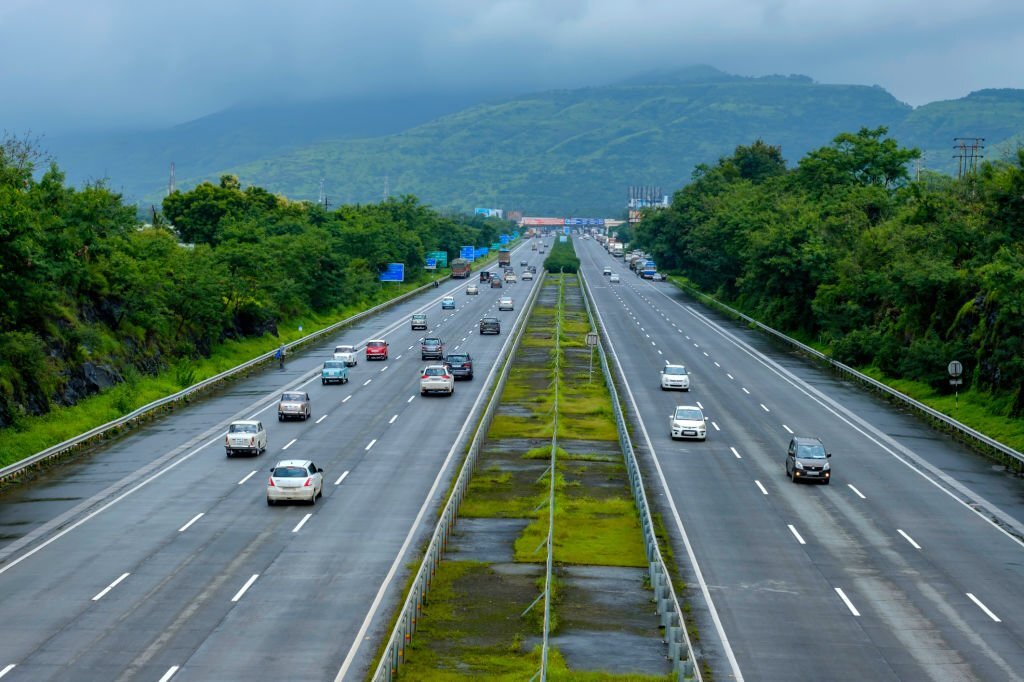
Revolutionizing India’s Toll Collection Landscape

The Government of India (GoI) has taken a significant step towards making the nation toll booth-free, as it recently announced ambitious plans to achieve this goal within a couple of years using GNSS-based toll collection. This visionary initiative aims to ensure seamless vehicle movement by eliminating all physical toll booths across the country’s highways, reducing congestion, and enhancing toll collection effectiveness. The GNSS-based tolling system improves the current electronic toll collection system, which uses RFID tags for automatic toll collection at Electronic Toll Collection (ETC) lanes, popularly known as FASTag. The MLFF and GNSS-based tolling system enable vehicles to travel on tolled roads without slowing down or using designated lanes. This improves traffic flow and decreases the need for roadside tolling infrastructure.
How GNSS-Based Tolling Works?
The GNSS-based tolling system utilizes virtual toll booths to monitor the entry and exit of vehicles from tolled sections. Virtual gantries installed along the tolled road network communicate with GNSS-enabled vehicles, eliminating the need for physical gantries. The device gathers critical vehicle information, such as registration number, type, and bank account details. As a vehicle passes through the virtual toll booth, the system automatically initiates tolling and deducts the toll amount from the user’s account.
India’s Proprietary Satellite Navigation

India has its own satellite navigation systems, namely GAGAN (GPS-Aided GEO Augmented Navigation) and NavIC (Navigation with Indian Constellation). These systems significantly boost the precision of satellite signals within India and even expand the coverage by up to 1,500 kilometres beyond its borders. This unique combination of GNSS and regional satellite navigation combination enables seamless vehicle tracking and efficient toll collection across India’s vast road network.
Advantages
- Flexible Charging Schemes: GNSS-based tolling allows for the implementation of various charging schemes, such as distance-based tolling, time-based tolling, or congestion-based tolling. This flexibility enables a fair and efficient toll collection system that caters to different road users’ needs.
- Low Infrastructure Investment: Compared to traditional toll plazas that require extensive roadside infrastructure and physical gantries, GNSS-based tolling systems significantly reduce the need for heavy infrastructure. Virtual toll booths eliminate the need for physical structures, resulting in cost savings and easier maintenance.
- Scalability: GNSS technology provides a scalable solution that can be easily expanded to cover more extensive road networks or accommodate future growth in traffic volume. As road networks evolve, GNSS-based tolling systems can adapt and scale up as road networks evolve without significant additional investment.
- Enhanced User Experience: With GNSS-based tolling, vehicles can travel without slowing down or stopping anywhere along the highway and expressway, leading to reduced traffic congestion and smoother journeys for commuters.
Challenges
- Accuracy: Ensuring precise location tracking is crucial for accurate toll calculations. GNSS-based tolling relies on satellite positioning, and occasional signal interference or inaccurate readings in urban canyons or rural areas may impact tolling accuracy.
- Privacy Concerns: The installation of GNSS devices in vehicles raises privacy concerns for some users. It is essential to implement robust data privacy measures and comply with regulations to safeguard user information and address privacy concerns.
- Standardization: The successful implementation of GNSS-based tolling requires standardized protocols and interfaces to ensure interoperability between different tolling systems and service providers. Establishing common standards will facilitate seamless integration and enhance user experience.
- Transition and Compatibility: Coordinating the transition from the existing FASTag system to GNSS-based tolling and ensuring compatibility with older vehicles present challenges. The government needs to devise plans to equip older vehicles with GNSS technology to achieve widespread adoption.
- Education and Awareness: Introducing a new tolling system requires educating users about its benefits, functionality, and how it differs from existing systems like FASTag. Raising awareness and providing instructions to users will ease the transition process and promote user acceptance.
Metro Infrasys as a Consultant
Come and be a part of the mission to shape India’s smart mobility future as we move towards a nation that is free of toll booths. At Metro Infrasys, we are committed to helping you achieve this goal and we invite all stakeholders to take advantage of our consultancy services for GNSS-based tolling. As India prepares for the launch of the world’s largest satellite-based tolling system, let us work together towards a transportation system that is both efficient and sustainable.